 The route from Ballater to Strathdon is 19.1 miles in length and has climbing of 1,864 feet. It has been given a difficulty rating of 7.Set entirely in the Cairngorm National Park, this cycle is not for the fainthearted it is magnificent, it is majestic, it is a monster! The route runs from the River Dee in the south to the River Don in the north and is a particular favourite at Ride the North. The first few miles run alongside the Gairn through beautiful countryside surrounded by good-sized hills. After crossing Gairnshiel Bridge, you are properly in mountain moorland and the road is very exposed – there is no mistaking that you are in the Cairngorms rather than Royal Deeside, and the views are breathtaking. Because of the elevation and the exposure, the winds can be swirling and difficult and you might want to think about carrying extra clothes.Ballater is a small town in Royal Deeside and the Cairngorm National Park. In the 14th century the land was owned by the estate of the Knights of St John, but a settlement wasnt properly established until 1770, first as a spa town and then as a tourist destination. It is now a mecca for outdoor sports, and also for enthusiasts of the Royal Family Balmoral is just 7 miles west. It is worth visiting Glenmuick Parish Church and the restored railway station, which was the terminus of the Aberdeen to Ballater line which closed in 1966.
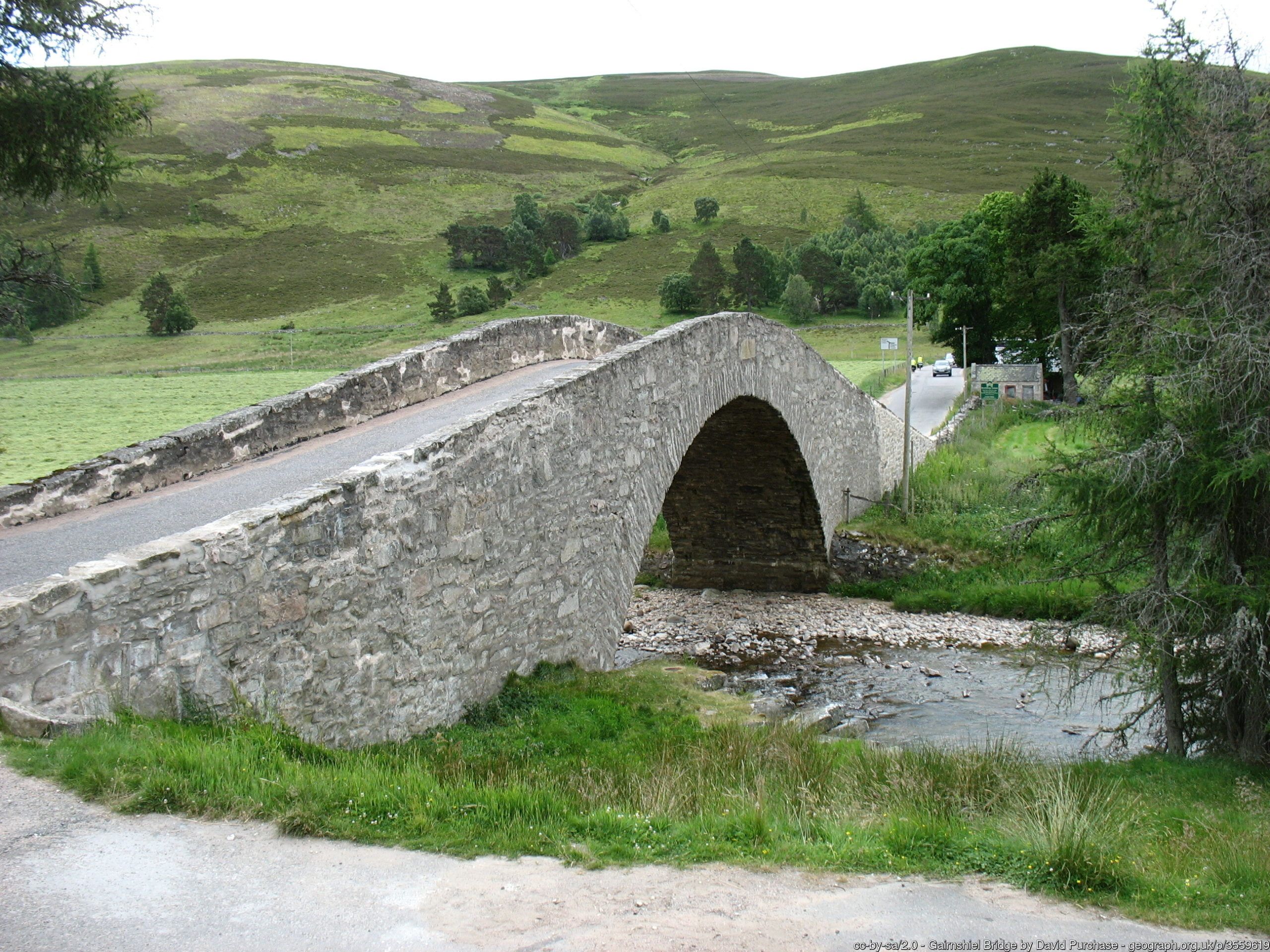 Starting in the centre of Ballater, you cycle along the main A93 road for the first 1.6 miles (please take care) before heading north. The road starts to rise from this point, and keeps on rising! The section to mile 7 is not particularly difficult, but that changes when you cross the lovely Gairnshiel Bridge (built in 1751) at 6.6 miles. You are now on Gairnshiel itself and you have to negotiate the toughest section first with gradients of over 10%. After a brief respite at mile 7.8, you continue to head up on steep gradients, reaching the high point of 1,801 feet after 10.1 miles. Youve now broken the back of the cycle, and will enjoy a well-deserved descent for the next 2.4 miles, before crossing the River Don and joining the A944 heading east at mile 12.5. The next 6.6 miles are rolling downhill and will be fast. You follow the Don through woodland, recrossing the river at mile 16 before entering Strathdon from the south, finishing in the village centre.Strathdon is a village, but it is also an informal geographical area which takes in Bellabeg. For many years the area was called Inverlochty due to its location at the confluence of the River Don and the Water of Lochty. There is a war memorial in the village, which hosts a traditional Highland Gathering. For cheese lovers, try out Strathdon Blue, Scotlands answer to Stilton. It is a small village so you should take extra provisions.
 By clicking on the play symbol on the graphic below you can see route map. The elevation profile of the ride can be seen via the Hills tab with files for use with a GPS device also available for download. If you take any photos of the route that youd like to share, please submit to neil@velodays.comOnward rides from Strathdon can be found here
Route map for Ballater To Strathdon by Neil Innes on plotaroute.com